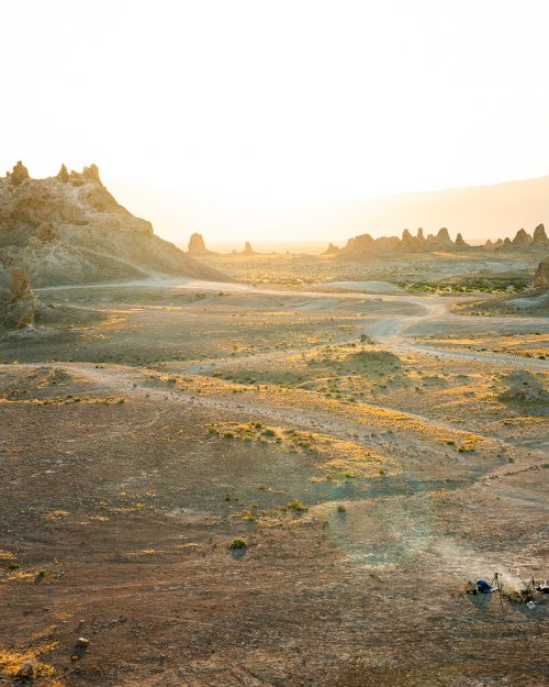
One of the biggest advantages I've found of living on the eastern side of Los Angeles is it's proximity to the mountains. Lone Pine, the home to Mt. Whitney portal, is maybe a three hour drive north which means when I have no plans during the weekend, a trip up here is an easy choice. This area is awe-inspiring to say the least. From Highway 395 you witness a dramatic 10k' wall of granite and it's home to Mt. Whitney which lays claim to the highest mountain in the lower 48. Having climbed that already and approaching the weekend with less time and preparation, I settled for a different fourteener just down the road: Mt. Langley.
Of the twelve fourteeners in California, Mt. Langley is described as being the easiest to summit. The path to the top is well groomed and easy to follow and getting there does not require any technical climbing skills. That being said, it's a long day no matter how you slice it. When I got back to the car, the stats on my All Trails app said 21.4 miles with 4,495' of elevation gain over a total time of 11 hours and 4 minutes. I was pooped.
The night before I left work around 6pm and made my way up. Getting there is simple. There is a walk in campsite right at the trailhead called Cottonwood Lakes Walk In Campground that I planned to stay at. After stopping for supplies and dinner, I arrived around 10:30pm to an almost full parking lot and a temperature of 32º F. Yummy. It's situations like these that make me wish I had a van so badly. Needless to say, I hustled to pay the camping fee and get my tent in order so I could go to bed. After setting an alarm for 5:30am, I was dead to the world.
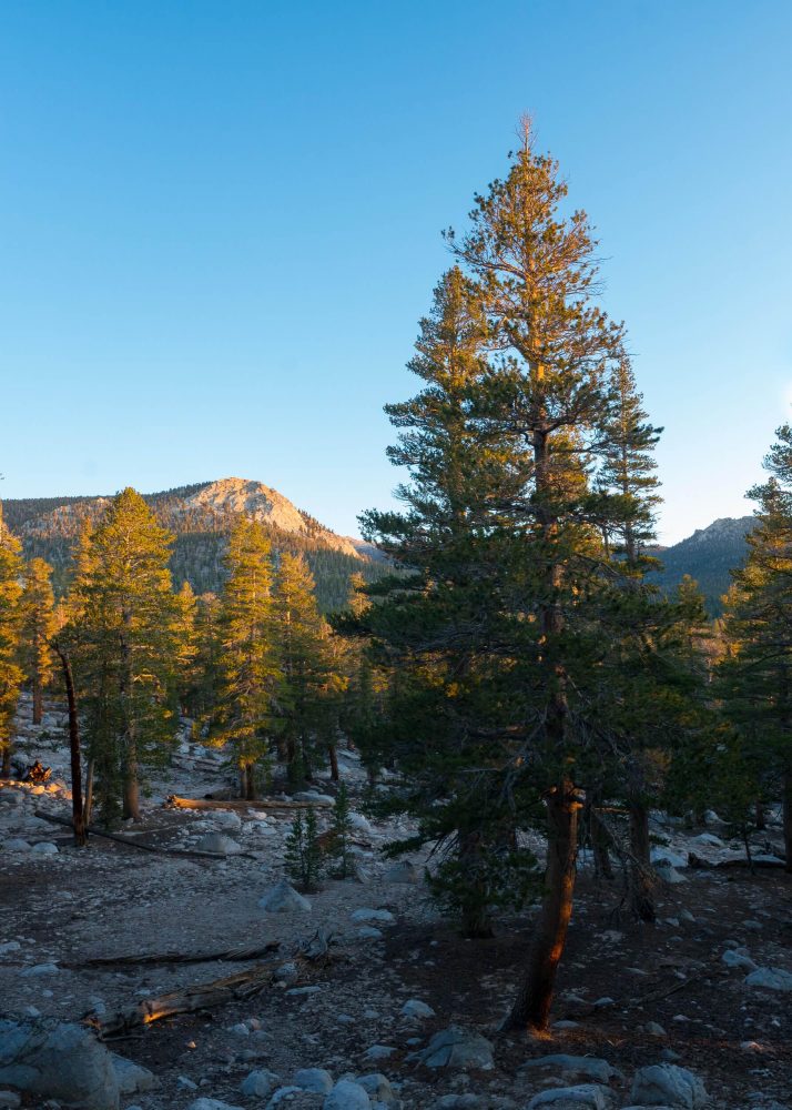
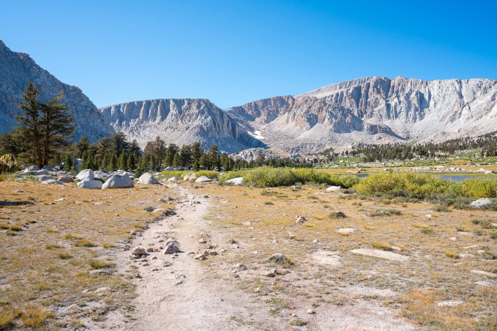
The next morning, I arose and was all packed up and on the trail by 6am. It was chilly, but I quickly lost layers within the first mile. The first several miles are relatively flat and forresty and I spent my time in that area chasing the warm glow of the rising sun on the mountains in the distance. Soon, I was above the tree line. It doesn't take much elevation gain to achieve this as the trailhead and the entirety of this hike is above 10k'. As you leave the trees, you are welcomed to an incredible sight as the middle part of this hike has you walking through a chain of watering holes called the, you guessed it, Cottonwood Lakes.
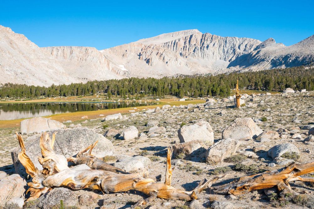
If I had more time, I would have made this hike a multi-day excursion and tried to obtain a permit to backpack in and setup camp at one of these lakes. Not only is the scenery here amazing, making for a great base camp, but it would cut up the hike to the summit nicely. I passed several groups of campers that had spent the night here and were relieved and happy the sun was back. Must have been a cold night. There are patches of trees here and there around the lakes, but the real focus from this point on are the drastic granite walls you will soon find yourself ascending.
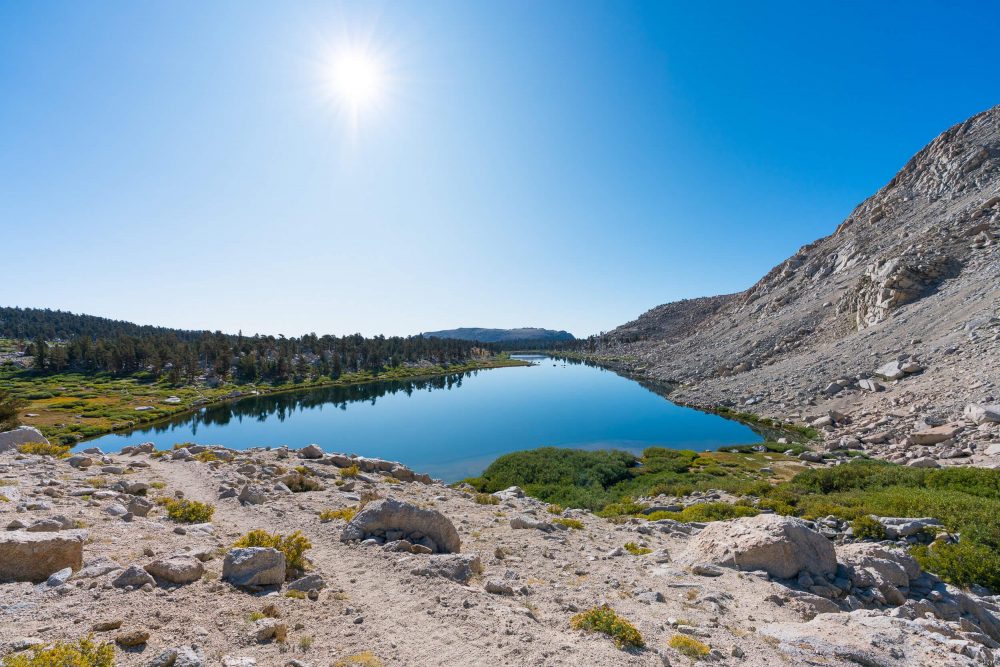
Cottonwood Lakes Number Three
One of the choices you'll have to make when hiking is whether to take New Army Pass or Old Army Pass. From what I understand, New Army Pass is a little longer, but better groomed. On the way up, I was following my All Trails map and I was not able to make a distinction between what was what as I was just able to see "Army Pass Trail", so I took that.
Turns out it was Old Army Pass. Up until this point the ascent was smooth, but this area was basically a bouldery scree field and steeper than anything I had hiked. I started to acknowledge heavier breaths. The altimeter on my phone said I was past 11k and on well on my way to 12.
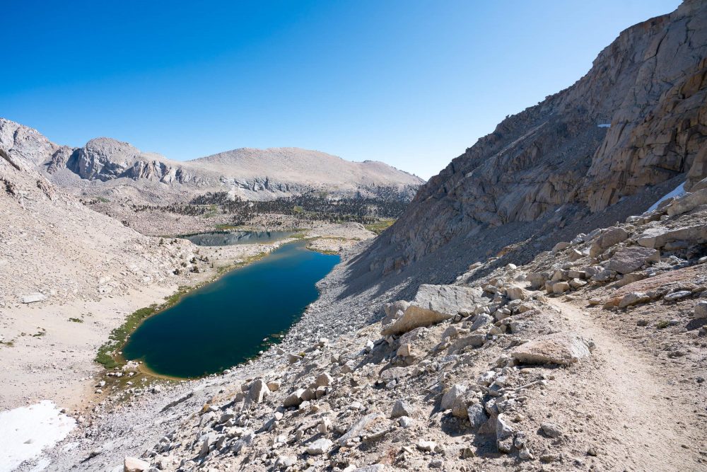
A look back at Cottonwood Lakes Four and Five.
As I climbed, the view down on Cottonwood Lakes Four and Five became more and more awesome. Near the top of the pass, there was a 100 foot long patch of snow from the previous season that I had to sketchily circumvent and some very novice scrambling, but I was soon at the top of the pass.
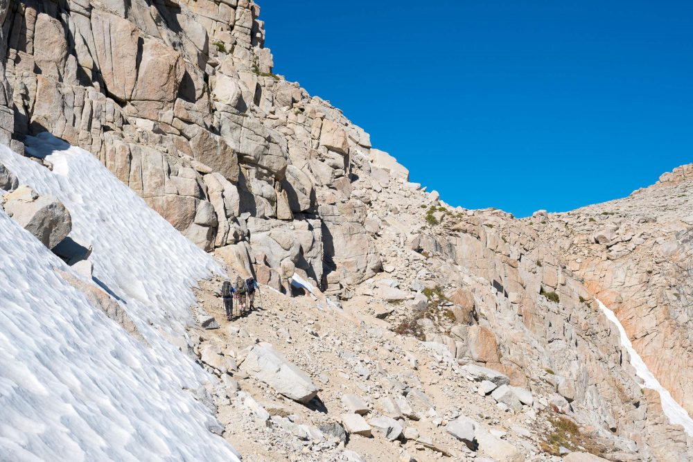
A group of hikers ahead of me, having circumnavigated the snow, approach the pass.
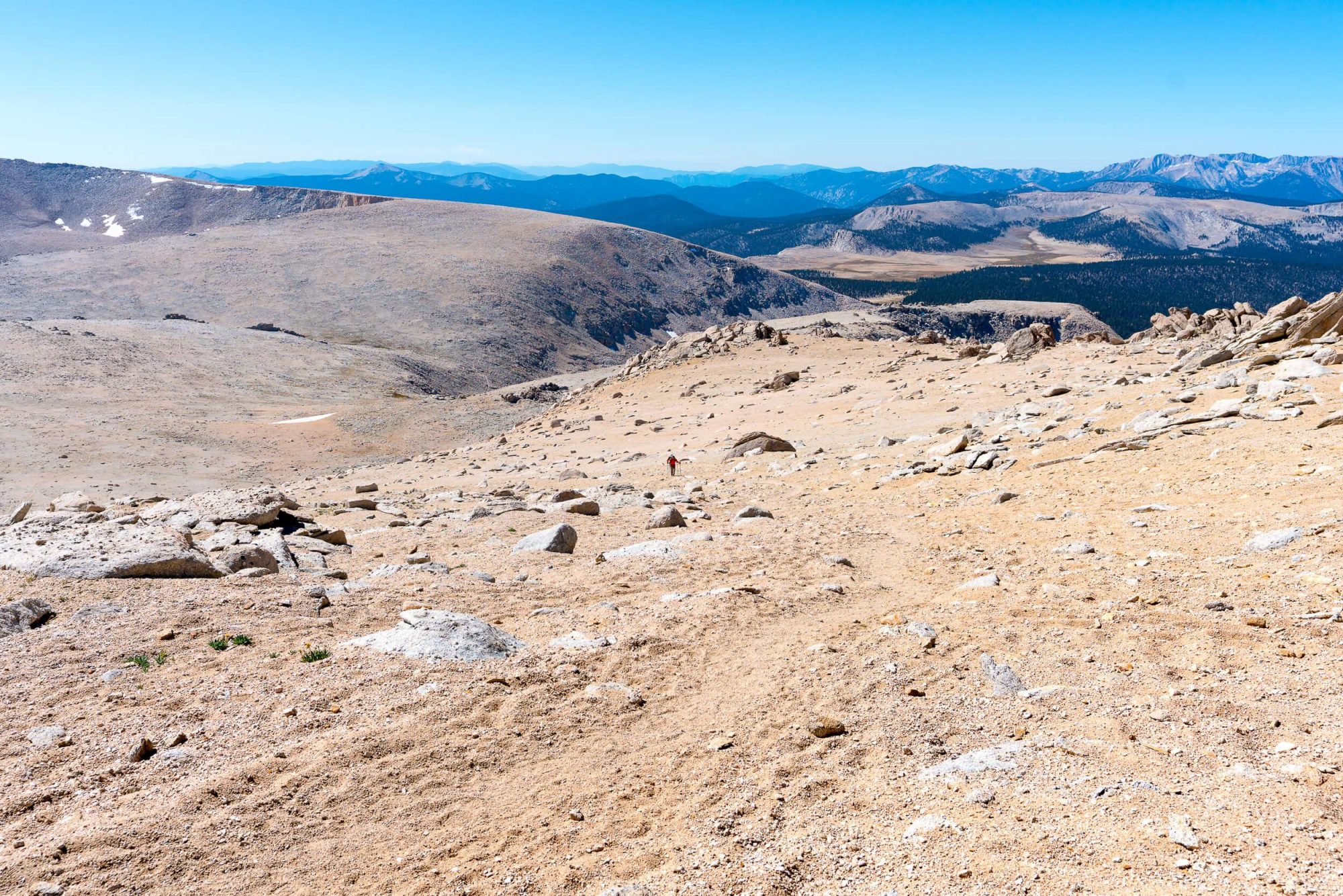
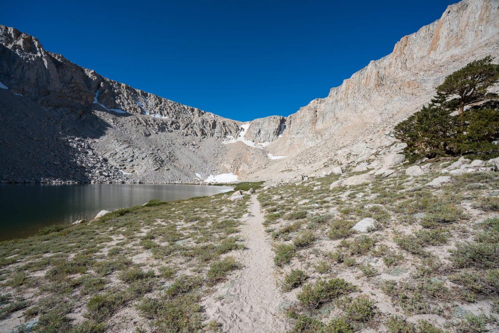
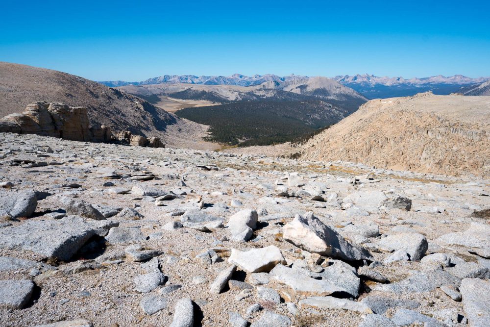
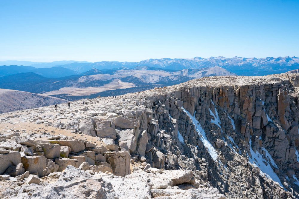
Along with a sign welcoming you to Sequoia National Park, you are immediately met with an incredible view into the heart of the Sierra Nevada - I'm talking mountains for days - and a what can be characterized as an otherworldly, super high, desert like environment. There are no trees here, just rocks, sand and patches of snow. It's neat to say the least and a nice, gradual incline to the north for a few miles allows you to catch your breath and enjoy the scenery while you approach the last major incline.
The hike can generally be broken down into five parts. The woods, the lakes, Army Pass, the desolate area after Army Pass and the final push to the summit. The last push sucks, unless you are into loose scree fields. I estimate this part it's about 1000 - 1500' and a mile or two. As long as you don't lose sight of the enormous cairns marking the way, you'll be fine.
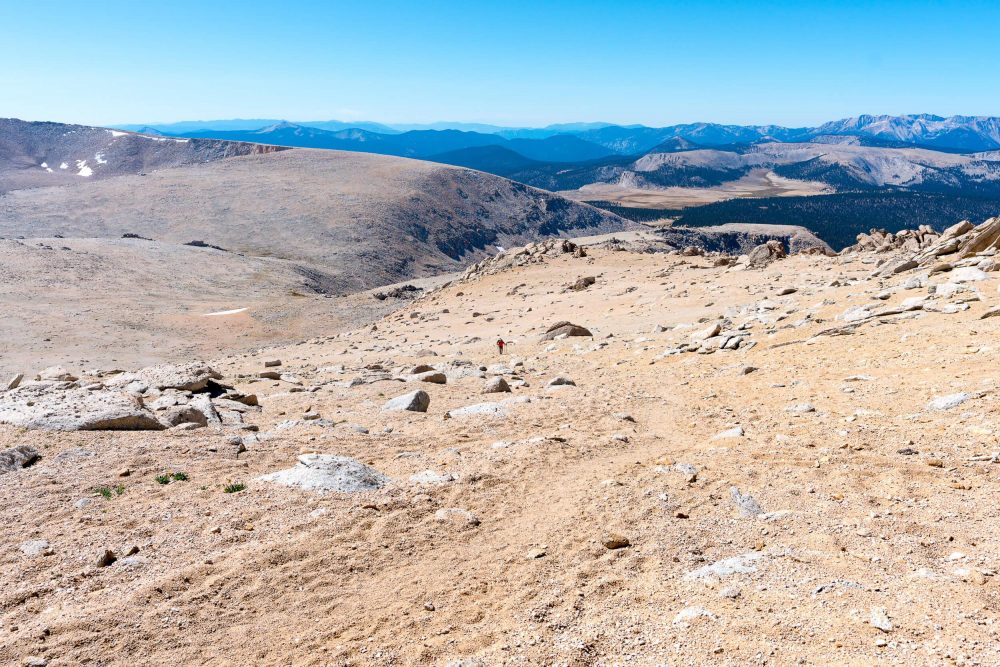
It was at this point I wished I had not forgotten my poles. My pace slowed dramatically as the ground consistently gave way beneath my steps, robbing me of energy. Frequent breaks, however, allowed me to soak in the scenery and before I knew it, I was at the top, just around noon. While I had spent almost every minute in sunshine with just a t-shirt on, it did not take very long at the top for me to want to put on a jacket. A peanut butter and jelly tortilla wrap and several photos later, my hands we going numb, so I decided to retreat down the mountain to make it to the car before sunset.
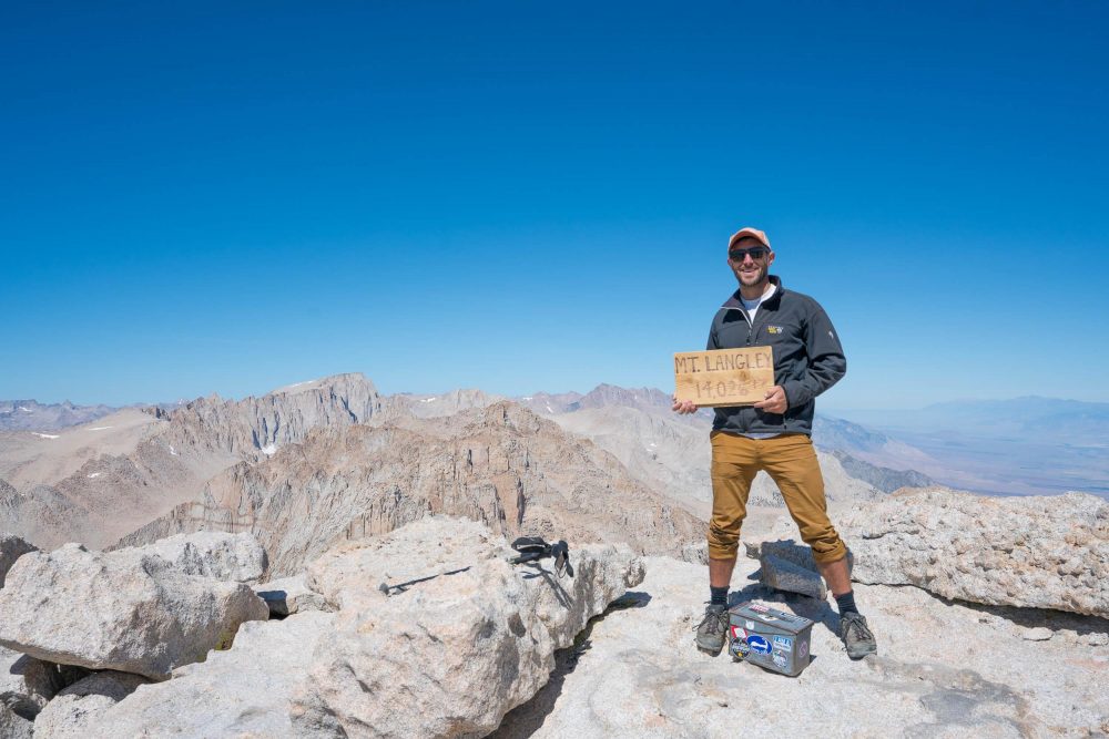
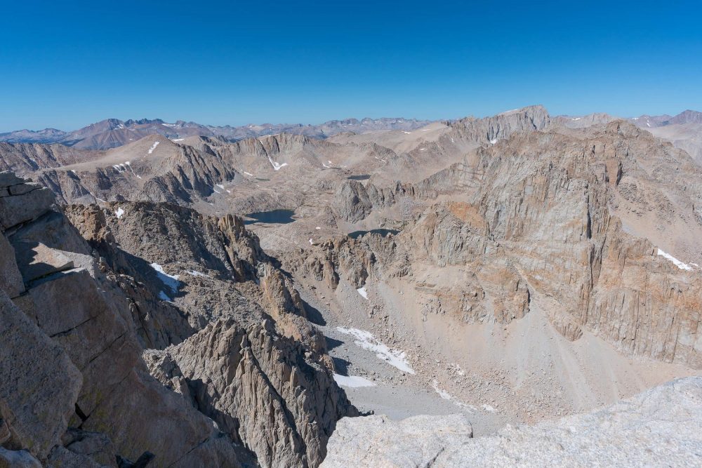
Left: Obligatory summit sign photo. If you were the guy who took this photo, thanks! Right: The view north from the summit. Crazy steep drops and a wonderful view of Mount Whitney.
The view south/southwest from the summit.
The way down the scree was far more enjoyable. The soft ground that prevented me from climbing, allowed me to descend without much effort. That part was a breeze. It wasn't until I got to Army Pass that I was reminded that my body was slightly tired. Uninterested in trading distance for ease of incline, I opted for the way I came up instead of going down New Army Pass. Whether or not that was a good decision is up for debate as Old Army Pass is all rocks and entirely uneven which required a lot of shock absorbing in the knees. It got old fast, but I kept trudging and soon I was back at the lakes.
It was warmer at the lakes and there were a lot more people out enjoying the sunshine then on the way up in the morning. The lake area definitely seems like an awesome place to setup a base camp and spend a day or two at as there is a lot to explore and the (I'm sure they are freezing) lakes begged to be jumped in. Some day I'll be back.
The view back from where I came towards the areas of Lakes 4 & 5.
Once I made it through the lake area, I had about five more miles to go and all I wanted was to be at the car. A part that was filled with excitement and thrill on the way up had been replaced with a feeling of just wanting it to be over. That mindset just made it longer. Luckily there were many other hikers making their way back to the trailhead as well and I was able to distract myself through conversation. That definitely helped, but periodically, my the rest of my body would check in to tell my brain I was an asshole for putting it through this, but again, I trudged forward, reminding myself of the horrible things that would happen to me if I decided to sleep on the side of the trail (I'd be fine, just really fucking cold). By the time I made it to the car, my feet did not feel like feet, but the sense of elation was through the roof. On the drive down, I want to say I stopped to enjoy the view, but I kid you not, it was to let my feet regain feeling. Was it worth it though? Fuck yes. Would I do it all in one day again? Ask me another time.